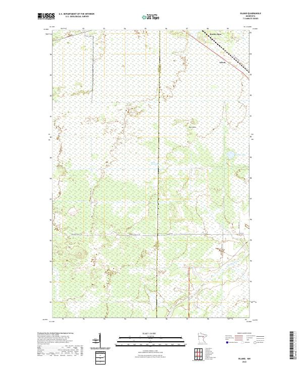
2022 Map of Island
USGS Topo · Published 2022About this map
The vast wetland complex of Island Farm Swamp dominates this area on the border of Aitkin and St. Louis counties. The landscape is characterized by intricate drainage patterns and low-lying terrain, including Sixteen Cr and the E Savanna River. Small settlements and historic railway-related locations are scattered along the northern corridor, most notably the hamlet of Island and the site of Hartley Spur near St Vincent Rd. Access to the interior of these wetlands is provided by forest routes such as the Hedbom Forest Trl and Hedbom Trl, which navigate around features like the curiously named Potshot Lake and the elevated ground of Big Island. The map illustrates a region where human footprint is secondary to the extensive natural hydrology and forest management of central Minnesota.
Find a feature on this map
19 named features on this map. Tap any name to fly to it.
Don’t see what you’re looking for? This feature index may not catch every label — zoom into the map to look around manually.
Map Details
Editions of this 2022 Island Map
This is the sole edition of this map. No revisions or reprints were ever made.
Other maps of this area

1953 · Duluth
USGS Topo · 1:250,000

1954 · Hibbing
USGS Topo · 1:250,000

1957 · Hibbing
USGS Topo · 1:250,000

1958 · Hibbing
USGS Topo · 1:250,000

1958 · Duluth
USGS Topo · 1:250,000

1963 · Prairie Lake
USGS Topo · 1:24,000

1963 · Toivola SW
USGS Topo · 1:24,000
1963 · Floodwood
USGS Topo · 1:24,000

1964 · Hibbing
USGS Topo · 1:250,000

1969 · Wawina
USGS Topo · 1:24,000