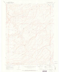
1969 Map of Island Mesa
USGS Topo · Published 1973About this map
Island Mesa and Horse Mesa define this dramatic stretch of the Colorado landscape, where the topography is dominated by deeply incised drainages and steep benches. The map captures the area in the late 1960s, a period when the high ground was navigated primarily via a network of Jeep Trails. Water sources like Corduroy Spring, Notch Spring, and End Spring provided critical points of interest in this arid environment. To the north and east, the Gunnison River snakes through the valley, flanked by the D & R G W RR tracks. The presence of Claypits and isolated Drill Holes suggests localized industrial and exploratory activity amidst the formidable terrain of Rough Canyon and Hells Hole.
Find a feature on this map
22 named features on this map. Tap any name to fly to it.
Don’t see what you’re looking for? This feature index may not catch every label — zoom into the map to look around manually.
Map Details
Editions of this 1969 Island Mesa Map
4 editions found
Other maps of this area

1934 · Colorado National Monument
USGS Topo · 1:24,000

1956 · Moab
USGS Topo · 1:250,000

1956 · Grand Junction
USGS Topo · 1:250,000

1959 · Grand Junction
USGS Topo · 1:250,000

1959 · Moab
USGS Topo · 1:250,000

1960 · Moab
USGS Topo · 1:250,000

1960 · Grand Junction
USGS Topo · 1:250,000

1962 · Moab
USGS Topo · 1:250,000

1962 · Grand Junction
USGS Topo · 1:250,000

1962 · Clifton
USGS Topo · 1:24,000