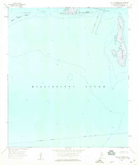
1958 Map of Isle Aux Herbes
USGS Topo · Published 1959About this map
The salt marshes and shallow waters of Mississippi Sound dominate this 1950s hydrographic and topographic study of Mobile County's coastline. The map focuses on the barrier islands and estuarine environment of the Gulf, most notably the large expanse of Isle Aux Herbes and the smaller Isle aux Dames. The coastal landscape is defined by the transition from open water to protected inlets like Grand Bay and Porters Ville Bay, separated by Pt aux Pins. Human intervention in this maritime environment is evident through the path of the Intracoastal Waterway and a designated Spoil Area near the shoals. Mariners and researchers can find specific soundings and navigation aids, including a light marking the passage between the islands and the mainland.
Find a feature on this map
14 named features on this map. Tap any name to fly to it.
Don’t see what you’re looking for? This feature index may not catch every label — zoom into the map to look around manually.
Map Details
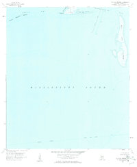
Editions of this 1958 Isle Aux Herbes Map
2 editions found
Other maps of this area

1921 · Grand Bay
USGS Topo · 1:62,500

1921 · Petit Bois Island
USGS Topo · 1:62,500

1921 · Dauphin Island
USGS Topo · 1:62,500

1921 · Delchamps
USGS Topo · 1:62,500

1941 · Cedar Point
USGS Topo · 1:62,500

1942 · Petit Bois Island
USGS Topo · 1:62,500

1942 · Fort Morgan
USGS Topo · 1:62,500

1943 · Cedar Point
USGS Topo · 1:62,500

1943 · Grand Bay
USGS Topo · 1:62,500

1953 · Mobile
USGS Topo · 1:250,000