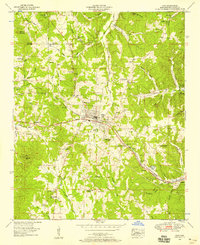
1953 Map of Iuka
USGS Topo · Published 1958About this map
Iuka sits at the heart of this Tishomingo County landscape, serving as a hub for the Southern railroad and the Southern Highway. The town is famously associated with the mineral waters found at Mineral Springs Park, a focal point of local activity during the mid-20th century. To the southwest, Woodall Mtn rises as a prominent topographical feature, while the John M Stone Memorial Marker stands as a specific point of local heritage.
Find a feature on this map
62 named features on this map. Tap any name to fly to it.
Don’t see what you’re looking for? This feature index may not catch every label — zoom into the map to look around manually.
Map Details
Editions of this 1953 Iuka Map
3 editions found
Other maps of this area

1911 · Iuka
USGS Topo · 1:48,000

1914 · Iuka
USGS Topo · 1:62,500

1935 · Holcut
USGS Topo · 1:24,000

1935 · Doskie
USGS Topo · 1:24,000

1935 · Iuka
USGS Topo · 1:24,000

1935 · Leedy
USGS Topo · 1:24,000

1936 · Margerum
USGS Topo · 1:24,000

1936 · Waterloo
USGS Topo · 1:24,000

1936 · Shaws
USGS Topo · 1:24,000

1936 · Bishop
USGS Topo · 1:24,000