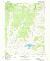
1967 Map of Jackson Draw
USGS Topo · Published 1970About this map
Matt Warner Reservoir dominates the southern portion of this high-plateau landscape, where the Base Line separates the north and south townships. Situated within the Ashley National Forest, the terrain is defined by complex drainage systems and high-elevation water management. The map details the technical infrastructure of the era, including a prominent pipeline and the Spillway controlling the reservoir's levels. Deeply incised features like Jackson Draw and Lambson Draw reveal the erosive forces at work on the Uintah County geography. The presence of numerous named springs and watercourses like Little Davenport Creek and Pot Creek highlights the critical importance of water rights and ranching resources in this arid environment during the late 1960s.
Find a feature on this map
22 named features on this map. Tap any name to fly to it.
Don’t see what you’re looking for? This feature index may not catch every label — zoom into the map to look around manually.
Map Details
Editions of this 1967 Jackson Draw Map
2 editions found
Other maps of this area

1885 · Ashley
USGS Topo · 1:250,000

1950 · Burnt Cabin Gorge
USGS Topo · 1:24,000

1950 · Blair Basin
USGS Topo · 1:24,000

1952 · Warren Draw
USGS Topo · 1:24,000

1952 · Clay Basin
USGS Topo · 1:24,000

1952 · Dutch John Mtn
USGS Topo · 1:24,000

1952 · Goslin Mtn
USGS Topo · 1:24,000

1954 · Vernal
USGS Topo · 1:250,000

1958 · Vernal
USGS Topo · 1:250,000

1960 · Vernal
USGS Topo · 1:250,000