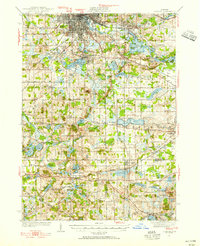
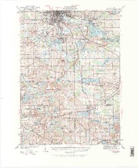
1935 Map of Jackson
USGS Topo · Published 1955About this map
Jackson serves as the industrial and transit anchor for this south-central Michigan landscape during the 1930s. The city is surrounded by a dense network of water bodies, including Vandercook Lake and Browns Lake, while the Grand River carves a path through the northeastern quadrant. The map reveals a mature late-19th-century rail infrastructure, with lines like the Michigan Central and Cincinnati Northern connecting regional hubs such as Brooklyn and Napoleon. A prominent Meridian line bisects the territory, highlighting the precision of early surveying.
Find a feature on this map
96 named features on this map. Tap any name to fly to it.
Don’t see what you’re looking for? This feature index may not catch every label — zoom into the map to look around manually.
Map Details
Editions of this 1935 Jackson Map
6 editions found
Other maps of this area

1919 · Stockbridge
USGS Topo · 1:62,500

1919 · Springport
USGS Topo · 1:62,500

1919 · Rives Junction
USGS Topo · 1:62,500

1921 · Rives Junction
USGS Topo · 1:62,500

1921 · Springport
USGS Topo · 1:62,500

1922 · Stockbridge
USGS Topo · 1:62,500

1935 · Jackson
USGS Topo · 1:48,000

1939 · Jackson
USGS Topo · 1:62,500

1942 · Stockbridge
USGS Topo · 1:62,500

1948 · Spring Arbor
USGS Topo · 1:62,500