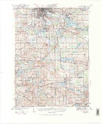
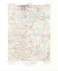
1935 Map of Jackson
USGS Topo · Published 1968About this map
Jackson stands at the heart of this mid-1930s landscape, serving as a hub for the Michigan Central railroad and a gateway to the surrounding lake country. The southern portion of the city is dominated by Ella Sharp Park, while the Grand River meanders northward through industrial and residential sectors. The map reveals a dense network of early 20th-century rural infrastructure, including a high concentration of one-room schoolhouses such as Herrington Sch and Ferguson Sch.
Find a feature on this map
102 named features on this map. Tap any name to fly to it.
Don’t see what you’re looking for? This feature index may not catch every label — zoom into the map to look around manually.
Map Details
Editions of this 1935 Jackson Map
6 editions found
Other maps of this area

1919 · Stockbridge
USGS Topo · 1:62,500

1919 · Springport
USGS Topo · 1:62,500

1919 · Rives Junction
USGS Topo · 1:62,500

1921 · Rives Junction
USGS Topo · 1:62,500

1921 · Springport
USGS Topo · 1:62,500

1922 · Stockbridge
USGS Topo · 1:62,500

1935 · Jackson
USGS Topo · 1:48,000

1939 · Jackson
USGS Topo · 1:62,500

1942 · Stockbridge
USGS Topo · 1:62,500

1948 · Spring Arbor
USGS Topo · 1:62,500