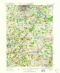
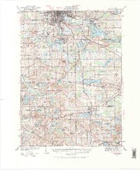
1935 Map of Jackson
USGS Topo · Published 1960About this map
The Grand River flows through the northern reaches of this landscape, anchoring the industrial and residential growth of Jackson and neighboring Vandercook Lake. Surveyed in the mid-1930s, the map documents a transition in transportation, showing both the active New York Central lines and segments of the Michigan Central (Abandoned) railroad. South of the city, the terrain is defined by an extensive network of kettle lakes and family-named schools, such as Hutchins Sch and Cullent Sch, which served the rural townships of Liberty and Columbia.
Find a feature on this map
91 named features on this map. Tap any name to fly to it.
Don’t see what you’re looking for? This feature index may not catch every label — zoom into the map to look around manually.
Map Details
Editions of this 1935 Jackson Map
6 editions found
Other maps of this area

1919 · Stockbridge
USGS Topo · 1:62,500

1919 · Springport
USGS Topo · 1:62,500

1919 · Rives Junction
USGS Topo · 1:62,500

1921 · Rives Junction
USGS Topo · 1:62,500

1921 · Springport
USGS Topo · 1:62,500

1922 · Stockbridge
USGS Topo · 1:62,500

1935 · Jackson
USGS Topo · 1:48,000

1939 · Jackson
USGS Topo · 1:62,500

1942 · Stockbridge
USGS Topo · 1:62,500

1948 · Spring Arbor
USGS Topo · 1:62,500