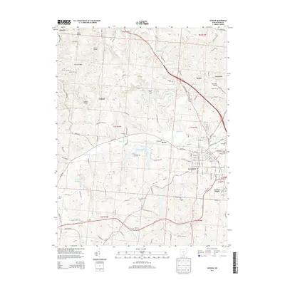
2013 Map of Jackson
USGS Topo · Published 2013About this map
Jackson, Ohio, and its surrounding townships are defined by a complex landscape of hollows and ridges, with the town center situated at the confluence of several vital watercourses including Salt-Lick Cr and Sugar Run. The 2013 landscape reveals a community tightly linked to its geography, where residential clusters like Jackson Heights and Jonestown sit alongside significant local water bodies such as Hammertown Lake and Lake Katharine. Genealogists will find an exceptionally dense concentration of family and community burial grounds, from the Landrum Cem in the north to the Mt Zion Cem and Mt Olivet Cem further south.
Find a feature on this map
83 named features on this map. Tap any name to fly to it.
Don’t see what you’re looking for? This feature index may not catch every label — zoom into the map to look around manually.
Map Details
Editions of this 2013 Jackson Map
This is the sole edition of this map. No revisions or reprints were ever made.
Other maps of this area

1906 · Waverly
USGS Topo · 1:62,500

1908 · Waverly
USGS Topo · 1:62,500

1911 · Sciotoville
USGS Topo · 1:62,500

1912 · Oak Hill
USGS Topo · 1:62,500

1913 · Sciotoville
USGS Topo · 1:62,500

1913 · Jackson
USGS Topo · 1:62,500

1944 · Jackson
USGS Topo · 1:62,500

1947 · Columbus
USGS Topo · 1:250,000

1957 · Huntington
USGS Topo · 1:250,000

1960 · Huntington
USGS Topo · 1:250,000