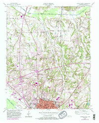
1950 Map of Jackson North
USGS Topo · Published 1984About this map
Jackson anchors the southern portion of this mid-century survey, revealing the city's northward expansion toward the Middle Fork Forked Deer River. The landscape is a transition from the urban core of the Jackson High Sch and Lane College vicinity to the rural outskirts and small communities like Oakfield and Gilmore. This era shows a well-defined institutional and social landscape, with numerous country schools such as Pope Sch and Brown Sch alongside local landmarks like the Jackson Country Club.
Find a feature on this map
54 named features on this map. Tap any name to fly to it.
Don’t see what you’re looking for? This feature index may not catch every label — zoom into the map to look around manually.
Map Details
Editions of this 1950 Jackson North Map
5 editions found
Other maps of this area

1950 · Jackson South
USGS Topo · 1:24,000

1950 · Jackson North
USGS Topo · 1:24,000

1951 · Jackson North
USGS Topo · 1:24,000

1953 · Claybrook
USGS Topo · 1:24,000

1953 · Beech Bluff
USGS Topo · 1:24,000

1956 · Blytheville
USGS Topo · 1:250,000

1959 · Medina
USGS Topo · 1:24,000

1959 · Blytheville
USGS Topo · 1:250,000

1959 · Westover
USGS Topo · 1:24,000

1959 · Adair
USGS Topo · 1:24,000