1961 Map of Jacksonville
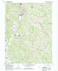
USGS Topo · Published 1973About this map
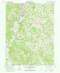
Sunday Creek carves a deep path through the coal-rich hills of northern Athens County, defining the early industrial character of this region. The 1961 landscape is a mix of small mining settlements and rural townships, with the New York Central railroad serving as the vital artery connecting Glouster, Trimble, and Jacksonville. Heavy extraction is evident through numerous operations like the Tipple Mine and several Strip Mines, which contrast with the older, community-focused sites such as the Township High Sch and the Covered Bridge near Truetown. Local genealogy is well-preserved across the ridges, from the Millfield Hilltop Cem to smaller family plots like the Brown Cem. The southern reach of the map transitions into the Wayne National Forest, where the terrain rises toward Mt Nebo and Scatter Ridge, while the Hocking River touches the southwestern corner near Chauncey.
Find a feature on this map
76 named features on this map. Tap any name to fly to it.
Don’t see what you’re looking for? This feature index may not catch every label — zoom into the map to look around manually.
Map Details
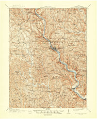
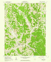
Editions of this 1961 Jacksonville Map
5 editions found
Other maps of this area

1903 · Athens
USGS Topo · 1:62,500

1904 · Chesterhill
USGS Topo · 1:62,500

1905 · Athens
USGS Topo · 1:62,500

1906 · Chesterhill
USGS Topo · 1:62,500
1910 · Mc Connelsville
USGS Topo · 1:62,500
1911 · New Lexington
USGS Topo · 1:62,500

1947 · Columbus
USGS Topo · 1:250,000

1949 · Clarksburg
USGS Topo · 1:250,000

1956 · Clarksburg
USGS Topo · 1:250,000
1960 · Amesville
USGS Topo · 1:24,000
Featured Places
- Glouster, Trimble Township
- Chauncey, Dover Township
- Jacksonville, Trimble Township
- Trimble, Trimble Township
- Liars Corner, Dover Township