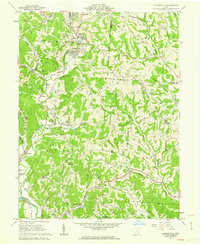
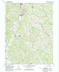
1961 Map of Jacksonville
USGS Topo · Published 1962About this map
Sunday Creek carves a deep industrial and agricultural valley through this portion of Athens County, anchoring a string of coal-era settlements including Glouster, Trimble, and Jacksonville. In the early 1960s, the landscape was a complex mosaic of extraction and community, where active Strip Mines and a Tipple operated alongside quiet landmarks like Queen of Heaven Ch and the Millfield Hilltop Cem. The transportation network is dominated by the New York Central and Chesapeake And Ohio railroads, which followed the watercourses to service the local mines and towns.
Find a feature on this map
67 named features on this map. Tap any name to fly to it.
Don’t see what you’re looking for? This feature index may not catch every label — zoom into the map to look around manually.
Map Details
Editions of this 1961 Jacksonville Map
5 editions found
Other maps of this area

1903 · Athens
USGS Topo · 1:62,500

1904 · Chesterhill
USGS Topo · 1:62,500

1905 · Athens
USGS Topo · 1:62,500

1906 · Chesterhill
USGS Topo · 1:62,500

1910 · Mc Connelsville
USGS Topo · 1:62,500

1911 · New Lexington
USGS Topo · 1:62,500

1947 · Columbus
USGS Topo · 1:250,000

1949 · Clarksburg
USGS Topo · 1:250,000

1956 · Clarksburg
USGS Topo · 1:250,000

1960 · Amesville
USGS Topo · 1:24,000