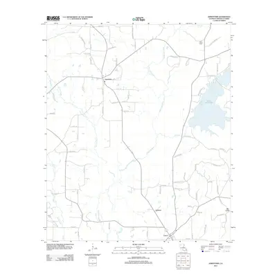
2012 Map of Jamestown
USGS Topo · Published 2012About this map
Jamestown and Castor anchor this biennial survey of northern Louisiana, where the winding course of Black Lake Bayou and its numerous tributaries dominate the landscape. The region's geography is defined by a dense network of watercourses, including Fourmile Bayou, Evans Br, and Wimberly Br, which cut through the low-lying terrain. The construction of the Kepler Dam Rd has created Kepler Creek Lake on the eastern side of the quadrangle, a significant local landmark alongside the Sailes Lookout Tower.
Find a feature on this map
73 named features on this map. Tap any name to fly to it.
Don’t see what you’re looking for? This feature index may not catch every label — zoom into the map to look around manually.
Map Details
Editions of this 2012 Jamestown Map
This is the sole edition of this map. No revisions or reprints were ever made.
Other maps of this area

1947 · Ringgold
USGS Topo · 1:62,500

1947 · Ashland
USGS Topo · 1:62,500

1948 · Coushatta
USGS Topo · 1:62,500

1948 · Jamestown
USGS Topo · 1:62,500

1949 · Jamestown
USGS Topo · 1:62,500

1955 · Shreveport
USGS Topo · 1:250,000

1956 · Shreveport
USGS Topo · 1:250,000

1956 · Ringgold
USGS Topo · 1:62,500
1957 · Coushatta
USGS Topo · 1:62,500

1957 · Ashland
USGS Topo · 1:62,500