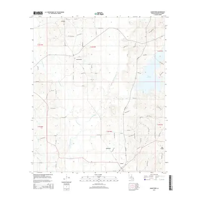
2015 Map of Jamestown
USGS Topo · Published 2015About this map
Castor and Jamestown anchor this Bienville Parish landscape, where the local road network follows the winding course of Black Lake Bayou and its numerous tributaries. In the mid-2010s, this area remained defined by its rural settlements and significant water features, including the prominent Kepler Creek Lake and Fourmile Bayou. The map captures a high degree of local detail for genealogists, showing names like Lawhon, Anderson, and Old Castor, alongside smaller drainages such as Wimberly Br and Evans Br. The transition from the established community at Castor to the outlying area of Old Castor suggests the shifting centers of local activity over time. Transportation is dominated by state routes like La-792 and a dense network of parish roads that navigate the low-lying wetlands and ridges of the North Louisiana terrain.
Find a feature on this map
78 named features on this map. Tap any name to fly to it.
Don’t see what you’re looking for? This feature index may not catch every label — zoom into the map to look around manually.
Map Details
Editions of this 2015 Jamestown Map
This is the sole edition of this map. No revisions or reprints were ever made.
Other maps of this area

1947 · Ringgold
USGS Topo · 1:62,500

1947 · Ashland
USGS Topo · 1:62,500

1948 · Coushatta
USGS Topo · 1:62,500

1948 · Jamestown
USGS Topo · 1:62,500

1949 · Jamestown
USGS Topo · 1:62,500

1955 · Shreveport
USGS Topo · 1:250,000

1956 · Shreveport
USGS Topo · 1:250,000

1956 · Ringgold
USGS Topo · 1:62,500
1957 · Coushatta
USGS Topo · 1:62,500

1957 · Ashland
USGS Topo · 1:62,500