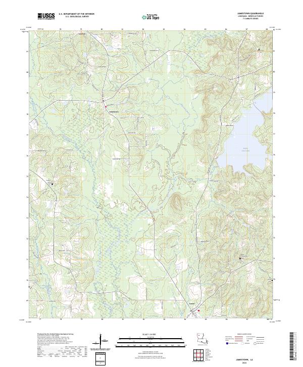
2024 Map of Jamestown
USGS Topo · Published 2024About this map
Jamestown and Castor anchor this portion of Bienville Parish, where the landscape is defined by the winding course of Black Lake Bayou and its numerous tributaries. The terrain transitions from the low-lying wetlands of Fourmile Bayou and Wimberly Branch to the open waters of Kepler Creek Lake in the east. This modern survey illustrates the persistent importance of early crossroads settlements like Lawhon and the rural road networks that link scattered family-named locations such as Sikes Orchard Rd and Watts Rd. Genealogists will find particular value in the documentation of several local burial grounds, including Mount Olive Cem and New Friendship Cem, which remain as core landmarks in this part of Louisiana. The distribution of these sites across the township and range lines reflects the long-standing community structure of the parish.
Find a feature on this map
66 named features on this map. Tap any name to fly to it.
Don’t see what you’re looking for? This feature index may not catch every label — zoom into the map to look around manually.
Map Details
Editions of this 2024 Jamestown Map
This is the sole edition of this map. No revisions or reprints were ever made.
Other maps of this area

1947 · Ringgold
USGS Topo · 1:62,500

1947 · Ashland
USGS Topo · 1:62,500

1948 · Coushatta
USGS Topo · 1:62,500

1948 · Jamestown
USGS Topo · 1:62,500

1949 · Jamestown
USGS Topo · 1:62,500

1955 · Shreveport
USGS Topo · 1:250,000

1956 · Shreveport
USGS Topo · 1:250,000

1956 · Ringgold
USGS Topo · 1:62,500
1957 · Coushatta
USGS Topo · 1:62,500

1957 · Ashland
USGS Topo · 1:62,500