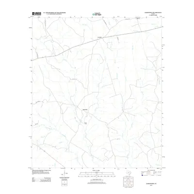
2012 Map of Jamestown
USGS Topo · Published 2012About this map
Farrsville and Jamestown anchor this part of Newton County, where the landscape is defined by an intricate network of waterways draining toward the east. The terrain is dominated by the winding course of Big Cow Cr, which is fed by numerous tributaries including Hunter Cr, Caney Br, and Little Caney Br. This area shows a pattern of rural settlement along established routes like Weeks Chapel Rd and Indian Hill Rd, reflecting a community integrated with the dense drainage systems of the Piney Woods. Significant local landmarks such as Lewis Gully and the northern reach of Yellow Bayou provide specific points of interest for those studying the physical geography and historical land use of the region.
Find a feature on this map
30 named features on this map. Tap any name to fly to it.
Don’t see what you’re looking for? This feature index may not catch every label — zoom into the map to look around manually.
Map Details
Editions of this 2012 Jamestown Map
This is the sole edition of this map. No revisions or reprints were ever made.
Other maps of this area

1944 · Wiergate
USGS Topo · 1:62,500

1948 · Wiergate
USGS Topo · 1:62,500

1952 · Lake Charles
USGS Topo · 1:250,000

1953 · Alexandria
USGS Topo · 1:250,000

1954 · Wiergate
USGS Topo · 1:24,000

1954 · Wiergate
USGS Topo · 1:62,500

1954 · Lake Charles
USGS Topo · 1:250,000

1955 · Alexandria
USGS Topo · 1:250,000

1955 · Roganville
USGS Topo · 1:62,500

1957 · Brookeland
USGS Topo · 1:62,500