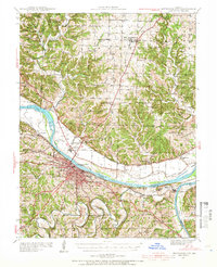
1939 Map of Jefferson City
USGS Topo · Published 1966About this map
Jefferson City serves as the focal point for this pre-war landscape, situated where the Missouri Pacific and Chicago and Alton railroads converge along the Missouri River. The capital's infrastructure is prominently displayed, including the State Prison Farm and the Lincoln Institute, alongside the Jefferson City Airport north of the river in Cedar City. The surrounding countryside across Cole and Callaway counties is densely dotted with rural social centers, from the Shumate Chapel to numerous small schoolhouses like Oak Grove Sch and Hawkins Sch. The convergence of the Osage River and Moreau River near Osage City highlights the importance of the river systems to the regional geography. To the north, the University of Missouri Game Preserve occupies a significant tract of land, while the Algoa Reformatory sits east of the city, illustrating the various state institutions that defined the area's development in the late 1930s.
Find a feature on this map
83 named features on this map. Tap any name to fly to it.
Don’t see what you’re looking for? This feature index may not catch every label — zoom into the map to look around manually.
Map Details
Editions of this 1939 Jefferson City Map
2 editions found
Other maps of this area

1886 · Jefferson City
USGS Topo · 1:125,000

1888 · Tuscumbia
USGS Topo · 1:125,000

1890 · Fulton
USGS Topo · 1:125,000

1894 · Tuscumbia
USGS Topo · 1:125,000

1894 · Jefferson City
USGS Topo · 1:125,000

1928 · Fulton
USGS Topo · 1:62,500

1931 · Fulton
USGS Topo · 1:62,500

1934 · Linn
USGS Topo · 1:48,000

1939 · Jefferson City
USGS Topo · 1:24,000

1939 · Jefferson City
USGS Topo · 1:62,500