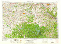
1959 Map of Jefferson City
USGS Topo · Published 1959About this map
The Missouri River and its southern tributaries define this mid-century landscape of central Missouri, where the state capital at Jefferson City sits at the confluence with the Osage River. To the west, the expansive reach of Lake of the Ozarks winds through the southern terrain near Camdenton, signaling the region's developing recreational and hydroelectric footprint. Major rail corridors including the Missouri Pacific and Missouri Kansas Texas connect regional centers like Sedalia, Boonville, and Warrensburg, following the traditional transport routes that historically bridged the agricultural prairie with river commerce. Military and educational presence is notable through Whiteman Air Force Base and the University of Missouri Wild Life Management Area near Columbia. This survey captures the integration of early interstate travel along U S 40 and U S 50 with the persistent rural fabric of small-town communities and local landmarks like Antioch Cemetery.
Find a feature on this map
39 named features on this map. Tap any name to fly to it.
Don’t see what you’re looking for? This feature index may not catch every label — zoom into the map to look around manually.
Map Details
Editions of this 1959 Jefferson City Map
This is the sole edition of this map. No revisions or reprints were ever made.
Other maps of this area

1884 · Bolivar
USGS Topo · 1:125,000

1885 · Warrensburg
USGS Topo · 1:125,000

1886 · Nevada
USGS Topo · 1:125,000

1886 · Jefferson City
USGS Topo · 1:125,000

1886 · Stockton
USGS Topo · 1:125,000

1887 · Clinton
USGS Topo · 1:125,000

1887 · Harrisonville
USGS Topo · 1:125,000

1887 · Sedalia
USGS Topo · 1:125,000

1887 · Warsaw
USGS Topo · 1:125,000

1887 · Butler
USGS Topo · 1:125,000