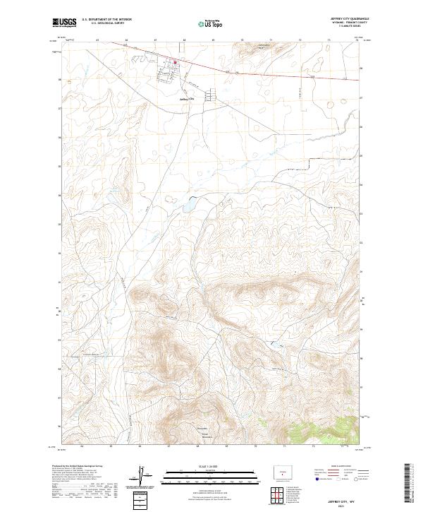
2021 Map of Jeffrey City
USGS Topo · Published 2021About this map
Jeffrey City stands at the northern edge of this high-desert landscape, a settlement whose grid of streets like Bob Adams Ave and Jackpot Dr suggests an era of planned growth. To the north, the distinctive Sweetwater Rocks rise above the drainage of O'Brian Creek, while the southern terrain ascends sharply into the Green Mountains and the heights of Sheep Mtn. The hydrology of the area is dominated by the seasonal paths of Crooks Creek and Sheep Creek, which wind toward the Kirk Reservoir. The road network, including Ore Rd and Lockhart Ranch Rd, reflects the area's history of ranching and resource extraction. This survey illustrates the contrast between the organized townsite and the expansive, complex topography of the Wyoming interior.
Find a feature on this map
30 named features on this map. Tap any name to fly to it.
Don’t see what you’re looking for? This feature index may not catch every label — zoom into the map to look around manually.
Map Details
Editions of this 2021 Jeffrey City Map
This is the sole edition of this map. No revisions or reprints were ever made.
Other maps of this area

1951 · Crooks Creek NE
USGS Topo · 1:24,000

1951 · Stampede Meadow
USGS Topo · 1:24,000

1951 · Black Rock Gap
USGS Topo · 1:24,000

1951 · Graham Ranch
USGS Topo · 1:24,000

1951 · Split Rock NW
USGS Topo · 1:24,000

1951 · Crooks Mountain
USGS Topo · 1:24,000

1955 · Casper
USGS Topo · 1:250,000

1957 · Jeffrey City
USGS Topo · 1:24,000

1958 · Casper
USGS Topo · 1:250,000

1961 · Crooks Peak
USGS Topo · 1:24,000