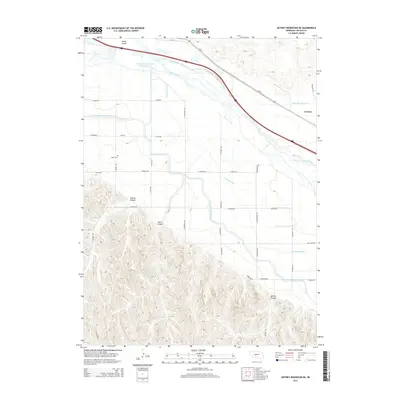
2014 Map of Jeffrey Reservoir NE
USGS Topo · Published 2014About this map
The Platte River valley dominates this Lincoln County landscape, showing a complex network of agricultural irrigation and water management infrastructure. The Gothenburg Diversion Dam Reservoir feeds into the Gothenburg Canal, while the Thirtymile Canal and Tri County Supply Canal carve through the terrain to support local farming. To the south, the topography shifts dramatically from the river bottom into a series of deep cuts including Jeffrey Canyon, Gulch Canyon, and Gilman Canyon. For genealogists and local historians, the Gastin Cem stands as a quiet marker of early settlement north of the canyon breaks. The small community of Vroman sits along the rail and road corridor of Us-30, paralleling the river. This survey captures the vital relationship between the Platte’s waters and the cultivated lands of the Nebraska plains.
Find a feature on this map
35 named features on this map. Tap any name to fly to it.
Don’t see what you’re looking for? This feature index may not catch every label — zoom into the map to look around manually.
Map Details
Editions of this 2014 Jeffrey Reservoir NE Map
This is the sole edition of this map. No revisions or reprints were ever made.
Other maps of this area

1902 · Gothenburg
USGS Topo · 1:125,000

1954 · McCook
USGS Topo · 1:250,000

1954 · North Platte
USGS Topo · 1:250,000

1956 · North Platte
USGS Topo · 1:250,000

1956 · Jeffrey Reservoir SW
USGS Topo · 1:24,000

1957 · North Platte
USGS Topo · 1:250,000

1957 · McCook
USGS Topo · 1:250,000

1958 · McCook
USGS Topo · 1:250,000

1967 · North Platte
USGS Topo · 1:250,000
1970 · Gothenburg
USGS Topo · 1:24,000