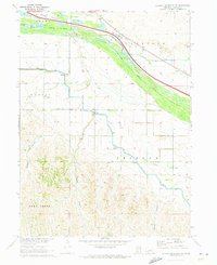
1970 Map of Jeffrey Reservoir NE
USGS Topo · Published 1973About this map
The Platte River corridor dominates this Lincoln County landscape, showing an intricate network of early 1970s water management. The map details several major irrigation routes, including the Tri County Supply Canal, Thirtymile Canal, and Gothenburg Canal, which trace the contours of the valley to support the region's agriculture. The southern half of the sheet transitions into more varied terrain defined by the Gaslin, Peckham, and Deer Creek districts, where numerous deep canyons like Jeffrey Canyon and Gilman Canyon cut through the upland plains.
Find a feature on this map
20 named features on this map. Tap any name to fly to it.
Don’t see what you’re looking for? This feature index may not catch every label — zoom into the map to look around manually.
Map Details
Editions of this 1970 Jeffrey Reservoir NE Map
This is the sole edition of this map. No revisions or reprints were ever made.
Other maps of this area

1902 · Gothenburg
USGS Topo · 1:125,000

1954 · McCook
USGS Topo · 1:250,000

1954 · North Platte
USGS Topo · 1:250,000

1956 · North Platte
USGS Topo · 1:250,000

1956 · Jeffrey Reservoir SW
USGS Topo · 1:24,000

1957 · North Platte
USGS Topo · 1:250,000

1957 · McCook
USGS Topo · 1:250,000

1958 · McCook
USGS Topo · 1:250,000

1967 · North Platte
USGS Topo · 1:250,000
1970 · Gothenburg
USGS Topo · 1:24,000