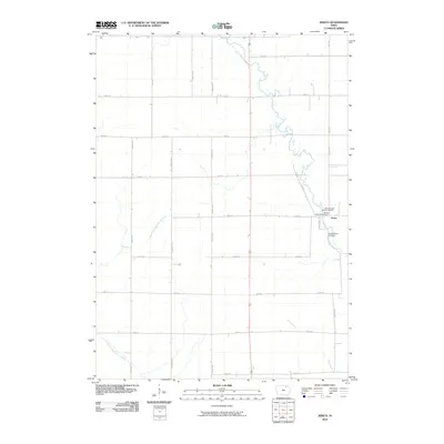
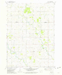
2010 Map of Jerico
USGS Topo · Published 2010About this map
The settlement of Jerico serves as the focal point of this Chickasaw County landscape, situated at the intersection of rural routes and farm-to-market roads. The area is defined by its agricultural layout, characterized by a dense grid of range and township roads like Co Hwy B22 and 120th St. Waterways including the East Fork Wapsipinicon River and Plum Creek meander through the prairie, influencing the placement of early homesteads. For those researching local heritage, the map identifies key religious and family burial sites, specifically the Saint Patricks Catholic Cemetery, the Jerico Lutheran Cemetery, and the more isolated Sargeant Farm Cemetery. This 2010 survey illustrates the enduring rural structure of northern Iowa, where small crossroads communities remain anchored by their parish histories and traditional land divisions.
Find a feature on this map
26 named features on this map. Tap any name to fly to it.
Don’t see what you’re looking for? This feature index may not catch every label — zoom into the map to look around manually.
Map Details
Editions of this 2010 Jerico Map
This is the sole edition of this map. No revisions or reprints were ever made.
Other maps of this area

1954 · Mason City
USGS Topo · 1:250,000

1957 · Mason City
USGS Topo · 1:250,000

1958 · Mason City
USGS Topo · 1:250,000
1972 · Ionia
USGS Topo · 1:24,000

1972 · Elma
USGS Topo · 1:24,000

1972 · Jerico
USGS Topo · 1:24,000
1972 · New Hampton
USGS Topo · 1:24,000

1981 · Lourdes
USGS Topo · 1:24,000
1981 · Lawler
USGS Topo · 1:24,000
1981 · Saude
USGS Topo · 1:24,000