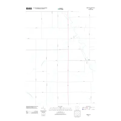
2013 Map of Jerico
USGS Topo · Published 2013About this map
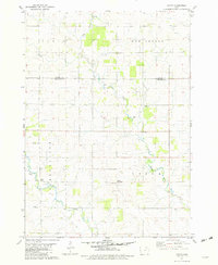
The agricultural landscape of Chickasaw County is defined here by the winding course of the E Fork Wapsipinicon River, which snakes through the western and central portions of the quadrangle. The small settlement of Jerico serves as the primary local landmark, situated at the junction of several county roads including Nolan Ave and 120th St. This area of northeastern Iowa is characterized by its organized grid of rural avenues and streets, such as March Ave and Odessa Ave, which partition the fertile land into distinct sections for farming.
Find a feature on this map
23 named features on this map. Tap any name to fly to it.
Don’t see what you’re looking for? This feature index may not catch every label — zoom into the map to look around manually.
Map Details
Editions of this 2013 Jerico Map
This is the sole edition of this map. No revisions or reprints were ever made.
Other maps of this area

1954 · Mason City
USGS Topo · 1:250,000

1957 · Mason City
USGS Topo · 1:250,000

1958 · Mason City
USGS Topo · 1:250,000
1972 · Ionia
USGS Topo · 1:24,000

1972 · Elma
USGS Topo · 1:24,000

1972 · Jerico
USGS Topo · 1:24,000
1972 · New Hampton
USGS Topo · 1:24,000

1981 · Lourdes
USGS Topo · 1:24,000
1981 · Lawler
USGS Topo · 1:24,000
1981 · Saude
USGS Topo · 1:24,000