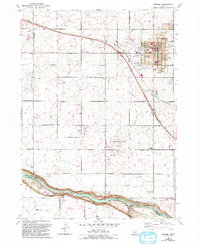
1979 Map of Jerome
USGS Topo · Published 1993About this map
Jerome serves as the focal point of this late-century survey, revealing a highly organized agricultural landscape defined by an extensive network of irrigation. The Union Pacific railroad and major corridors like Bob Barton Highway cut through a grid of section roads, including Appleton Road and North 3673 Road. These routes connect essential community hubs such as the Court House, Grange Hall, and several educational institutions like Appleton Sch and Canyonside School.
Find a feature on this map
46 named features on this map. Tap any name to fly to it.
Don’t see what you’re looking for? This feature index may not catch every label — zoom into the map to look around manually.
Map Details
Editions of this 1979 Jerome Map
2 editions found
Other maps of this area

1950 · Niagara Springs
USGS Topo · 1:24,000

1950 · Filer
USGS Topo · 1:24,000

1950 · Jerome
USGS Topo · 1:24,000

1950 · Jerome
USGS Topo · 1:62,500

1951 · Clover
USGS Topo · 1:24,000

1955 · Twin Falls
USGS Topo · 1:250,000

1958 · Twin Falls
USGS Topo · 1:250,000

1964 · Falls City
USGS Topo · 1:24,000

1964 · Twin Falls
USGS Topo · 1:24,000
1971 · Wendell
USGS Topo · 1:24,000