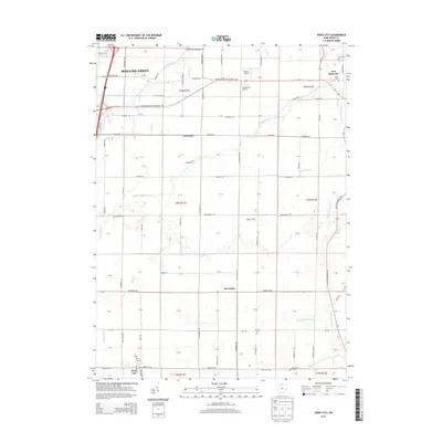
2013 Map of Jerry City
USGS Topo · Published 2013About this map
Bowling Green anchors the northwestern corner of this Wood County landscape, where the agricultural grid is defined by a dense network of country roads and local drainage systems. The survey highlights several small rural hubs and crossroads, including Jerry City, Six Points, and Cloverdale, which reflect the region's heritage as an intersection of farming and local commerce. Along the southeastern edge, New Rochester sits near the S Br Portage River, providing a focal point for genealogical research alongside several established burial grounds such as Fish Cem, Myers Cem, and the Jerry City Cem.
Find a feature on this map
64 named features on this map. Tap any name to fly to it.
Don’t see what you’re looking for? This feature index may not catch every label — zoom into the map to look around manually.
Map Details
Editions of this 2013 Jerry City Map
This is the sole edition of this map. No revisions or reprints were ever made.
Other maps of this area

1901 · Fostoria
USGS Topo · 1:62,500

1901 · Bowling Green
USGS Topo · 1:62,500

1901 · Elmore
USGS Topo · 1:62,500

1903 · Bowling Green
USGS Topo · 1:62,500

1903 · Fostoria
USGS Topo · 1:62,500

1903 · Findlay
USGS Topo · 1:62,500

1903 · Elmore
USGS Topo · 1:62,500
1938 · Tontogany
USGS Topo · 1:31,680
1952 · Tontogany
USGS Topo · 1:24,000

1956 · Toledo
USGS Topo · 1:250,000