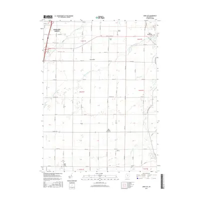
2016 Map of Jerry City
USGS Topo · Published 2016About this map
Jerry City and the southern outskirts of Bowling Green anchor this Wood County landscape, which is defined by an intricate network of agricultural drainage and the several branches of the Portage River. The transition from the more urbanized north to the rural crossroads of the south is marked by small settlements like Cloverdale, Six Points, and New Rochester. The map reveals a high density of small family and community burial grounds, such as City Cem, Myers Cem, Mount Zion Cem, and the Mennonite Cem, reflecting the deep-rooted settlement history of the region.
Find a feature on this map
112 named features on this map. Tap any name to fly to it.
Don’t see what you’re looking for? This feature index may not catch every label — zoom into the map to look around manually.
Map Details
Editions of this 2016 Jerry City Map
This is the sole edition of this map. No revisions or reprints were ever made.
Other maps of this area

1901 · Fostoria
USGS Topo · 1:62,500

1901 · Bowling Green
USGS Topo · 1:62,500

1901 · Elmore
USGS Topo · 1:62,500

1903 · Bowling Green
USGS Topo · 1:62,500

1903 · Fostoria
USGS Topo · 1:62,500

1903 · Findlay
USGS Topo · 1:62,500

1903 · Elmore
USGS Topo · 1:62,500
1938 · Tontogany
USGS Topo · 1:31,680
1952 · Tontogany
USGS Topo · 1:24,000

1956 · Toledo
USGS Topo · 1:250,000