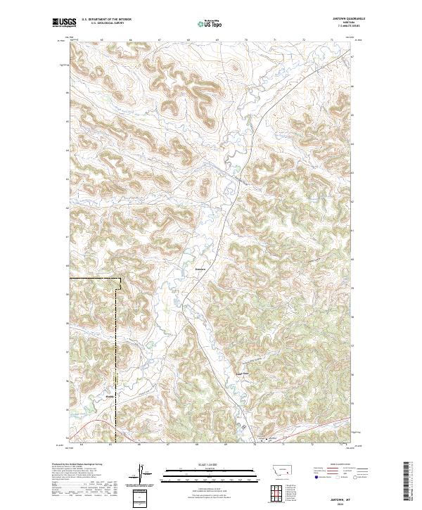
2024 Map of Jimtown
USGS Topo · Published 2024About this map
Rosebud Creek winds through this Northern Cheyenne landscape, carving a valley that anchors the settlements of Jimtown and Lame Deer. The terrain is defined by a dense network of coulees and gulches, including Davidson Coulee and Yellow Fox Gulch, which feed into the primary creek systems. In the southern portion of the map, Lame Deer serves as a significant hub, home to Chief Dull Knife College and the Lame Deer Cem. The geography is characterized by the divide between the Big Horn and Rosebud County line, with the small community of Muddy situated along the southwestern border. Ranching and local travel are supported by a web of rural routes like Rosebud Creek Cut-Off Rd and Lynch Coulee Rd, while several named springs such as the Isaac Kye Spring and Barb Wood Spring indicate critical water sources in this high plains environment.
Find a feature on this map
27 named features on this map. Tap any name to fly to it.
Don’t see what you’re looking for? This feature index may not catch every label — zoom into the map to look around manually.
Map Details
Editions of this 2024 Jimtown Map
This is the sole edition of this map. No revisions or reprints were ever made.
Other maps of this area

1954 · Hardin
USGS Topo · 1:250,000

1957 · Hardin
USGS Topo · 1:250,000

1958 · Hardin
USGS Topo · 1:250,000

1958 · Painted Hill
USGS Topo · 1:24,000

1958 · Jimtown
USGS Topo · 1:24,000

1958 · Black Spring
USGS Topo · 1:24,000

1958 · Fisher Butte
USGS Topo · 1:24,000

1958 · Lame Deer
USGS Topo · 1:24,000

1958 · Badger Peak
USGS Topo · 1:24,000

1971 · Colstrip SW
USGS Topo · 1:24,000