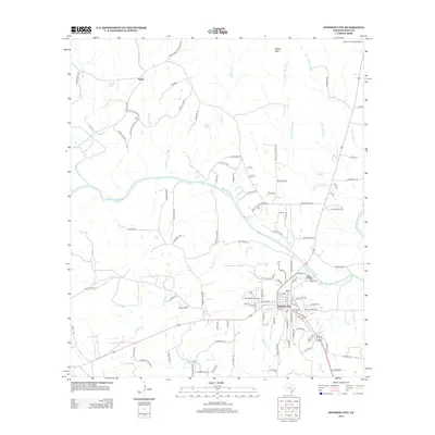
2012 Map of Johnson City
USGS Topo · Published 2012About this map
The Pedernales River carves through the heart of this Central Texas landscape, defining the topography of Blanco County. To the north, the small settlement of Sandy sits near the Sandy Cem, while the county seat of Johnson City anchor the southern portion of the map. The terrain is marked by numerous water sources, including Buffalo Springs, Hobbs Spring, and Crofts Springs, which likely served as vital landmarks for early settlers and ranchers.
Find a feature on this map
112 named features on this map. Tap any name to fly to it.
Don’t see what you’re looking for? This feature index may not catch every label — zoom into the map to look around manually.
Map Details
Editions of this 2012 Johnson City Map
This is the sole edition of this map. No revisions or reprints were ever made.
Other maps of this area

1887 · Blanco
USGS Topo · 1:125,000

1894 · Fredericksburg
USGS Topo · 1:125,000

1894 · Blanco
USGS Topo · 1:125,000

1954 · Llano
USGS Topo · 1:250,000

1955 · Llano
USGS Topo · 1:250,000

1956 · Llano
USGS Topo · 1:250,000

1961 · Hye
USGS Topo · 1:24,000

1961 · Rocky Creek
USGS Topo · 1:24,000
1961 · Johnson City
USGS Topo · 1:24,000

1963 · Yeager Creek
USGS Topo · 1:24,000