
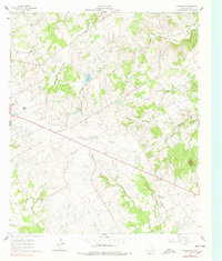
1961 Map of Johnsville
USGS Topo · Published 1962About this map
Duffau Creek and its various tributaries, including Little Duffau Creek and Richardson Creek, carve through this section of Erath County. Small rural centers like Johnsville and Selden anchor a landscape defined by ranching and small-scale agriculture during the early 1960s. The map reveals the placement of several family and community landmarks essential for genealogists, such as Aycock Cem and Hatchett Cem, alongside local congregations at Mitchell Creek Ch and Pony Creek Ch.
Find a feature on this map
21 named features on this map. Tap any name to fly to it.
Don’t see what you’re looking for? This feature index may not catch every label — zoom into the map to look around manually.
Map Details
Editions of this 1961 Johnsville Map
2 editions found
Other maps of this area

1889 · Granbury
USGS Topo · 1:125,000

1890 · Stephenville
USGS Topo · 1:125,000

1920 · Stephenville
USGS Topo · 1:125,000

1931 · Tolar
USGS Topo · 1:62,500

1954 · Dallas
USGS Topo · 1:250,000

1954 · Abilene
USGS Topo · 1:250,000

1958 · Dallas
USGS Topo · 1:250,000

1958 · Abilene
USGS Topo · 1:250,000
1961 · Alexander
USGS Topo · 1:24,000

1961 · Knob Hill
USGS Topo · 1:24,000