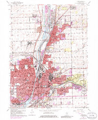
1962 Map of Joliet
USGS Topo · Published 1986About this map
The industrial and institutional heart of Will County is revealed here during a period of significant mid-century expansion. The complex geography of Joliet is defined by the parallel paths of the Des Plaines River, the Illinois and Michigan Canal, and the Chicago Sanitary and Ship Canal, which together create a corridor of heavy industry and transit. Large-scale facilities such as the State Prison and an Oil Refinery dominate the northern landscape, while the city core is dense with parish life, including St Paul Sch and St Raymonds Sch. On the eastern edge, the transition from urban sprawl to preserved natural spaces is marked by the expansive Pilcher Park and Higinbotham Woods. This 1962 survey, updated with 1973 photogrammetric data, captures the growing residential suburbs of Crest Hill and Ingalls Park as they pushed into formerly open land.
Find a feature on this map
99 named features on this map. Tap any name to fly to it.
Don’t see what you’re looking for? This feature index may not catch every label — zoom into the map to look around manually.
Map Details
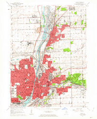
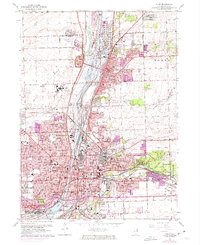
Editions of this 1962 Joliet Map
3 editions found
Other maps of this area

1890 · Des Plaines
USGS Topo · 1:62,500

1892 · Joliet
USGS Topo · 1:62,500

1892 · Wilmington
USGS Topo · 1:62,500

1894 · Des Plaines
USGS Topo · 1:62,500

1900 · Des Plaines
USGS Topo · 1:62,500

1901 · Des Plaines
USGS Topo · 1:62,500

1918 · Wilmington
USGS Topo · 1:62,500

1923 · Joliet
USGS Topo · 1:62,500

1928 · Sag Bridge
USGS Topo · 1:24,000

1929 · Brisbane
USGS Topo · 1:24,000