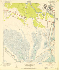
1943 Map of Jones Creek
USGS Topo · Published 1956About this map
The Brazos River meanders toward the Gulf of Mexico in this coastal survey, defining a landscape of low-lying marshes and industrial transition. To the east, the settlements of Velasco and Freeport stand at the river's mouth, while the interior reveals a pattern of rural community life centered around Jones Creek and Perry Landing. The map documents a significant network of water-based transportation and infrastructure, from the prominent Intracoastal Waterway and its older predecessor to the elevated land of Bryan Mound. Cultural landmarks are scattered throughout the agricultural and marshy terrain, including the Oakland Sch and several houses of worship such as St Joseph Ch and Peach Point Ch. The presence of the Clemens State Farm in the northwest and the Velasco Cem near the river provides specific genealogical and institutional points of interest.
Find a feature on this map
26 named features on this map. Tap any name to fly to it.
Don’t see what you’re looking for? This feature index may not catch every label — zoom into the map to look around manually.
Map Details
Editions of this 1943 Jones Creek Map
2 editions found
Other maps of this area

1943 · Oyster Creek
USGS Topo · 1:31,680

1943 · Jones Creek
USGS Topo · 1:31,680

1943 · Freeport
USGS Topo · 1:31,680

1943 · Cedar Lakes East
USGS Topo · 1:24,000

1943 · Snipe
USGS Topo · 1:31,680

1950 · Houston
USGS Topo · 1:250,000

1951 · Bay City
USGS Topo · 1:250,000

1952 · Cedar Lane NE
USGS Topo · 1:24,000

1952 · Cedar Lakes West
USGS Topo · 1:24,000

1952 · Brazoria
USGS Topo · 1:24,000