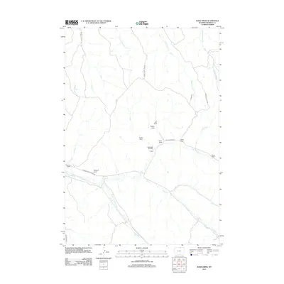
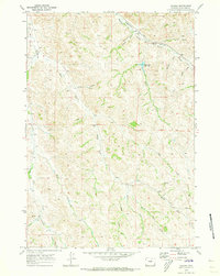
2012 Map of Jones Draw
USGS Topo · Published 2012About this map
Jones Draw defines the central topography of this Sheridan County landscape, where a complex network of ephemeral drainages and creeks shapes the high plains. The drainage pattern is particularly dense here, with Arkansas Cr and Dutch Cr carving distinct paths across the southern half of the quadrangle. Local naming conventions are well-preserved, reflecting the area's ranching heritage through labels such as Lanbaugh Number 4 Draw, Baxter Draw, and Windmill Draw. Transport in this open country relies on a scattered network of rural routes, including the Sheridan-Ulm-Clearmont Rd and Buffalo Creek Rd, which navigate between the various draws and creek prongs like Hill Prong Badger Cr and N Prong S R Cr.
Find a feature on this map
25 named features on this map. Tap any name to fly to it.
Don’t see what you’re looking for? This feature index may not catch every label — zoom into the map to look around manually.
Map Details
Editions of this 2012 Jones Draw Map
This is the sole edition of this map. No revisions or reprints were ever made.
Other maps of this area

1909 · Sheridan
USGS Topo · 1:125,000

1911 · Sheridan
USGS Topo · 1:125,000

1955 · Sheridan
USGS Topo · 1:250,000

1958 · Sheridan
USGS Topo · 1:250,000

1962 · Sheridan
USGS Topo · 1:250,000

1967 · Buffalo Run Creek
USGS Topo · 1:24,000
1968 · Bar N Draw
USGS Topo · 1:24,000
1968 · Wyarno
USGS Topo · 1:24,000
1970 · O T O Ranch
USGS Topo · 1:24,000
1970 · Verona
USGS Topo · 1:24,000