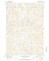
1970 Map of Jones Draw
USGS Topo · Published 1973About this map
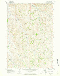
Burlington Northern railroad tracks cut across the southwestern corner of this Sheridan County landscape, following the drainage of Wagner Prong toward Dutch Creek. The terrain is defined by an intricate network of ephemeral watercourses and draws, including Lanabaugh Draw, Jones Draw, and Coutant Draw, which feed into larger systems like S R Creek and Arkansas Creek. This 1970 field survey illustrates a sparsely settled ranching environment where land use is marked by scattered improvements such as a Corral, a Landing Field in the northeast, and a Windmill near the center of the quadrangle. A system of unimproved roads and a Jeep Trail provide the primary means of navigating the breaks and hills between these seasonal waterways.
Find a feature on this map
26 named features on this map. Tap any name to fly to it.
Don’t see what you’re looking for? This feature index may not catch every label — zoom into the map to look around manually.
Map Details
Editions of this 1970 Jones Draw Map
This is the sole edition of this map. No revisions or reprints were ever made.
Other maps of this area

1909 · Sheridan
USGS Topo · 1:125,000

1911 · Sheridan
USGS Topo · 1:125,000

1955 · Sheridan
USGS Topo · 1:250,000

1958 · Sheridan
USGS Topo · 1:250,000

1962 · Sheridan
USGS Topo · 1:250,000

1967 · Buffalo Run Creek
USGS Topo · 1:24,000
1968 · Bar N Draw
USGS Topo · 1:24,000
1968 · Wyarno
USGS Topo · 1:24,000
1970 · O T O Ranch
USGS Topo · 1:24,000
1970 · Verona
USGS Topo · 1:24,000