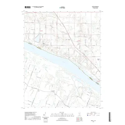
2018 Map of Joppa
USGS Topo · Published 2018About this map
Joppa occupies the northern bank of the Ohio River in this modern survey of the Illinois and Kentucky borderlands. The landscape transitions from the river's edge, marked by Snake Slough and Bean Br, to the agricultural uplands of Massac County. Small communities like Choat and Rossington anchor the road network, while several family and community burial grounds, including Kirkendall Cem, Liberty Ridge Cem, and Brewer Cem, provide significant touchstones for local genealogists. The terrain is defined by a dense network of watercourses such as Bayou Cr and Nasty Cr, which drain into the main river valley. Near the eastern edge, the Metropolis Municipal Airport and Oak Glen Lake signify more recent development, yet the overall pattern of land use remains tied to the traditional crossroads and rural settlements that have characterized this riverine corridor for generations.
Find a feature on this map
104 named features on this map. Tap any name to fly to it.
Don’t see what you’re looking for? This feature index may not catch every label — zoom into the map to look around manually.
Map Details
Editions of this 2018 Joppa Map
This is the sole edition of this map. No revisions or reprints were ever made.
Other maps of this area

1917 · Brownfield
USGS Topo · 1:62,500

1918 · Vienna
USGS Topo · 1:62,500

1919 · Vienna
USGS Topo · 1:62,500

1926 · Paducah
USGS Topo · 1:62,500

1928 · La Center
USGS Topo · 1:62,500

1929 · Paducah
USGS Topo · 1:62,500

1932 · La Center
USGS Topo · 1:62,500

1940 · Paducah
USGS Topo · 1:62,500

1942 · Vienna
USGS Topo · 1:62,500

1949 · Paducah
USGS Topo · 1:250,000