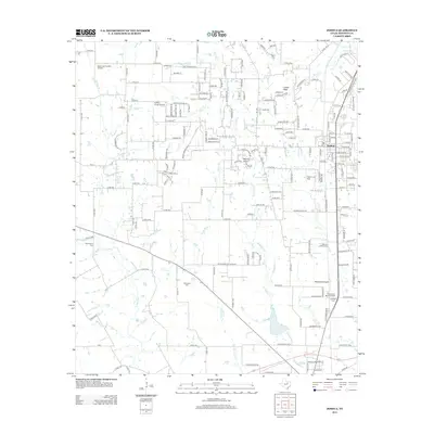
2012 Map of Joshua
USGS Topo · Published 2012About this map
Caddo Peak and Brushy Knob dominate the local topography of this Johnson County landscape during the early 21st century. The growing community of Joshua is the primary settlement, characterized by a grid of streets such as 8th St and College St. This era shows a distinctive mix of rural heritage and modern aviation, with multiple small landing strips including Benjamin Franklin Airport, Buffalo Chips Airpark, and Blackwood Airpark scattered across the countryside. Genealogists will find significant value in the numerous historical burial sites documented here, such as Caddo Cem, Old Bethany Cem, and Old Lane Prairie Cem. The drainage patterns of the Nolan River and McAnear Cr define the lower reaches of the map, while Lanes End marks a smaller named residential cluster near the center.
Find a feature on this map
168 named features on this map. Tap any name to fly to it.
Don’t see what you’re looking for? This feature index may not catch every label — zoom into the map to look around manually.
Map Details
Editions of this 2012 Joshua Map
This is the sole edition of this map. No revisions or reprints were ever made.
Other maps of this area

1889 · Granbury
USGS Topo · 1:125,000

1891 · Weatherford
USGS Topo · 1:125,000

1891 · Cleburne
USGS Topo · 1:125,000

1893 · Weatherford
USGS Topo · 1:125,000

1894 · Cleburne
USGS Topo · 1:125,000

1894 · Fort Worth
USGS Topo · 1:125,000

1928 · Godley
USGS Topo · 1:62,500

1954 · Dallas
USGS Topo · 1:250,000

1955 · Burleson
USGS Topo · 1:24,000

1955 · Primrose
USGS Topo · 1:24,000