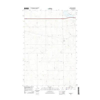
2014 Map of Judson
USGS Topo · Published 2014About this map
The small settlement of Judson serves as a central landmark in this portion of Morton County, situated amidst the high plains where agriculture and transportation intersect. The landscape is defined by the headwaters and drainage of Sweetbriar Cr, which flows toward the northeast into Sweet Briar Lake. This reservoir and its accompanying Sweet Briar Lake Trl mark a primary point of interest in an area otherwise dominated by a rigid grid of section-line roads such as 39th Ave and 40th St. In the southern portion of the quadrangle, the terrain transitions toward the drainage of Fish Cr, illustrating the subtle topographic divides that characterize the North Dakota prairie. The map provides a clear record of the modern rural infrastructure, including the placement of high-speed transit corridors and local access roads that connect the dispersed ranching and farming operations surrounding the Judson community.
Find a feature on this map
18 named features on this map. Tap any name to fly to it.
Don’t see what you’re looking for? This feature index may not catch every label — zoom into the map to look around manually.
Map Details
Editions of this 2014 Judson Map
This is the sole edition of this map. No revisions or reprints were ever made.
Other maps of this area

1954 · Bismarck
USGS Topo · 1:250,000

1958 · Bismarck
USGS Topo · 1:250,000

1960 · New Salem
USGS Topo · 1:24,000

1970 · New Salem NW
USGS Topo · 1:24,000

1970 · Judson
USGS Topo · 1:24,000

1970 · New Salem NE
USGS Topo · 1:24,000

1972 · Sweet Briar
USGS Topo · 1:24,000

1972 · Crown Butte NW
USGS Topo · 1:24,000

1980 · Green Ridge
USGS Topo · 1:24,000

1980 · Almont East
USGS Topo · 1:24,000