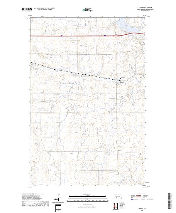
2024 Map of Judson
USGS Topo · Published 2024About this map
The small settlement of Judson serves as the focal point for this rural Morton County landscape, which transitions between modern infrastructure and early transportation routes. Situated along the township lines of t139n r84w and t139n r85w, the area is defined by its agricultural layout and water features like Sweet Briar Lake in the northeast and Fish Creek to the south. Local history is anchored by the Judson Cem, located just west of the town center near 40th St. The map illustrates the layering of travel history, showing the path of Old Hwy 10 running parallel to modern Interstate 94, tracing the evolution of movement across the Great Plains.
Find a feature on this map
22 named features on this map. Tap any name to fly to it.
Don’t see what you’re looking for? This feature index may not catch every label — zoom into the map to look around manually.
Map Details
Editions of this 2024 Judson Map
This is the sole edition of this map. No revisions or reprints were ever made.
Other maps of this area

1954 · Bismarck
USGS Topo · 1:250,000

1958 · Bismarck
USGS Topo · 1:250,000

1960 · New Salem
USGS Topo · 1:24,000

1970 · New Salem NW
USGS Topo · 1:24,000

1970 · Judson
USGS Topo · 1:24,000

1970 · New Salem NE
USGS Topo · 1:24,000

1972 · Sweet Briar
USGS Topo · 1:24,000

1972 · Crown Butte NW
USGS Topo · 1:24,000

1980 · Green Ridge
USGS Topo · 1:24,000

1980 · Almont East
USGS Topo · 1:24,000