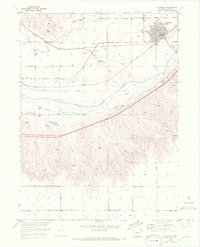
1953 Map of Julesburg
USGS Topo · Published 1972About this map
The South Platte River corridor near the Nebraska border reveals a landscape defined by pioneer-era defense and early 20th-century irrigation. Near the southern bank, the Fort Julesburg (Ruins) and a nearby Historical Marker identify the site of a vital mid-19th-century overland station. The northern bank is dominated by the town of Julesburg, where the Union Pacific railroad and the Julesburg Water Works anchor the community.
Find a feature on this map
27 named features on this map. Tap any name to fly to it.
Don’t see what you’re looking for? This feature index may not catch every label — zoom into the map to look around manually.
Map Details
Editions of this 1953 Julesburg Map
5 editions found
Other maps of this area

1900 · Chappell
USGS Topo · 1:125,000

1952 · Julesburg SW
USGS Topo · 1:24,000

1952 · Julesburg SE
USGS Topo · 1:24,000

1953 · Ovid
USGS Topo · 1:24,000

1953 · Julesburg
USGS Topo · 1:24,000

1954 · Sterling
USGS Topo · 1:250,000

1954 · Scottsbluff
USGS Topo · 1:250,000

1958 · Scottsbluff
USGS Topo · 1:250,000

1958 · Sterling
USGS Topo · 1:250,000

1961 · Chappell
USGS Topo · 1:24,000