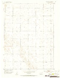
1952 Map of Julesburg SW
USGS Topo · Published 1953About this map
Woodham Cemetery serves as a central landmark in this portion of Sedgwick County, where the high plains landscape is defined by its agricultural utility and scattered rural institutions. During the early 1950s, the region saw a shift in community structure, as evidenced by several educational sites already noted as obsolete, including the Prairie View School and Westside School. Meanwhile, the Never Fail School remains a point of local activity amidst the section lines and windmills that dot the terrain. The topography is influenced by the Sand Draw drainage, which cuts through the undulating surface near several Gravel Pits, illustrating the local extraction and ranching economy characteristic of this Missouri River Basin development area.
Find a feature on this map
7 named features on this map. Tap any name to fly to it.
Don’t see what you’re looking for? This feature index may not catch every label — zoom into the map to look around manually.
Map Details
Editions of this 1952 Julesburg SW Map
3 editions found
Other maps of this area

1952 · Julesburg SW
USGS Topo · 1:24,000

1952 · Julesburg SE
USGS Topo · 1:24,000

1952 · Marks Butte
USGS Topo · 1:24,000

1953 · Ovid
USGS Topo · 1:24,000

1953 · Julesburg
USGS Topo · 1:24,000

1953 · Sedgwick
USGS Topo · 1:24,000

1954 · Sterling
USGS Topo · 1:250,000

1958 · Sterling
USGS Topo · 1:250,000

1962 · Holyoke NE
USGS Topo · 1:24,000

1962 · Haxtun East
USGS Topo · 1:24,000