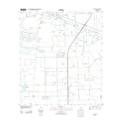
2013 Map of Juliff
USGS Topo · Published 2013About this map
The lowlands of Brazoria County are defined by the winding paths of Oyster Cr and Chocolate Bayou, which drain toward the Gulf through a landscape of prairie and wetlands. By 2013, the region shows a mix of traditional industry and newer residential growth. The Arcola Oil Field remains a significant marker of the area's extraction history, while the rural community of Juliff and the expanding Iowa Colony reflect the transition from agricultural roots to suburban development.
Find a feature on this map
94 named features on this map. Tap any name to fly to it.
Don’t see what you’re looking for? This feature index may not catch every label — zoom into the map to look around manually.
Map Details
Editions of this 2013 Juliff Map
This is the sole edition of this map. No revisions or reprints were ever made.
Other maps of this area

1920 · Mykawa
USGS Topo · 1:31,680

1920 · Almeda
USGS Topo · 1:31,680

1943 · Rosharon
USGS Topo · 1:31,680

1943 · Juliff
USGS Topo · 1:31,680

1943 · Chocolate Bayou
USGS Topo · 1:24,000

1950 · Houston
USGS Topo · 1:250,000

1953 · Otey
USGS Topo · 1:24,000

1953 · Thompsons
USGS Topo · 1:24,000
1955 · Pearland
USGS Topo · 1:24,000
1955 · Almeda
USGS Topo · 1:24,000