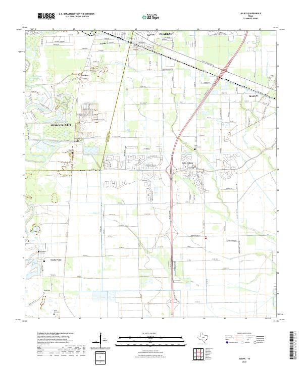
2022 Map of Juliff
USGS Topo · Published 2022About this map
W Fork Chocolate Bayou and Oyster Creek wind through this landscape on the Fort Bend Co Brazoria Co line, where suburban expansion meets legacy ranchlands and industrial corridors. Recent residential development is visible in the clusters of Iowa Colony and Arcola, yet the map preserves traces of the area's agricultural and logistical past, most notably the route of the Old Sugarland Railroad near Missouri City.
Find a feature on this map
116 named features on this map. Tap any name to fly to it.
Don’t see what you’re looking for? This feature index may not catch every label — zoom into the map to look around manually.
Map Details
Editions of this 2022 Juliff Map
This is the sole edition of this map. No revisions or reprints were ever made.
Other maps of this area

1920 · Mykawa
USGS Topo · 1:31,680

1920 · Almeda
USGS Topo · 1:31,680

1943 · Rosharon
USGS Topo · 1:31,680

1943 · Juliff
USGS Topo · 1:31,680

1943 · Chocolate Bayou
USGS Topo · 1:24,000

1950 · Houston
USGS Topo · 1:250,000

1953 · Otey
USGS Topo · 1:24,000

1953 · Thompsons
USGS Topo · 1:24,000
1955 · Pearland
USGS Topo · 1:24,000
1955 · Almeda
USGS Topo · 1:24,000