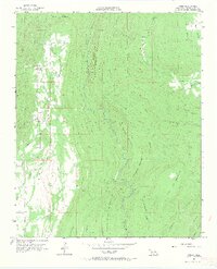
1957 Map of Jumbo
USGS Topo · Published 1967About this map
Jumbo serves as the primary focal point of this mid-century survey, situated at the head of Impson Valley. The landscape is defined by the sharp verticality of the Ouachita Mountains, where Buck Mountain and White Rock Mountain loom over a network of isolated creek beds. Geologic and industrial interests are evident through the presence of oil wells in the southern valley and specialized sites like Salt Lick and Marble. The drainage pattern is intricate, with Tenmile Creek and Buck Creek carving through the terrain, joined by smaller tributaries like Monkeywrench Creek and Whisky Creek. This topographic record provides a clear look at the dispersed settlement and resource extraction in Pushmataha County before more modern development reached these ridges.
Find a feature on this map
30 named features on this map. Tap any name to fly to it.
Don’t see what you’re looking for? This feature index may not catch every label — zoom into the map to look around manually.
Map Details
Editions of this 1957 Jumbo Map
4 editions found
Other maps of this area

1898 · McAlester
USGS Topo · 1:125,000

1901 · Antlers
USGS Topo · 1:125,000

1909 · Mc Alester
USGS Topo · 1:125,000

1912 · Antlers
USGS Topo · 1:125,000

1925 · Antlers
USGS Topo · 1:125,000

1950 · Mcalester
USGS Topo · 1:250,000

1957 · Farris
USGS Topo · 1:24,000

1957 · Moyers
USGS Topo · 1:24,000

1957 · Jumbo
USGS Topo · 1:24,000

1957 · Lane NE
USGS Topo · 1:24,000