
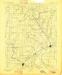
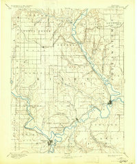
1894 Map of Junction City
USGS Topo · Published 1894About this map
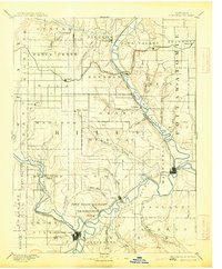
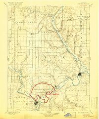
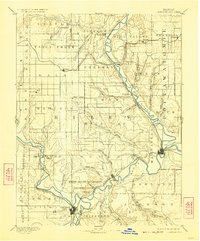
Fort Riley Military Reservation anchors the central landscape of this 1880s survey, marking a significant military presence at the confluence where the Republican River and Smoky Hill River meet to form the Kansas River. The regional economy of the late nineteenth century is clearly defined by a dense network of rail lines, including the Union Pacific Railroad and the Kansas Central Railroad, which connected burgeoning frontier towns like Junction City and Manhattan.
Find a feature on this map
60 named features on this map. Tap any name to fly to it.
Don’t see what you’re looking for? This feature index may not catch every label — zoom into the map to look around manually.
Map Details
Editions of this 1894 Junction City Map
7 editions found
Other maps of this area

1885 · Eskridge
USGS Topo · 1:125,000

1886 · Junction City
USGS Topo · 1:125,000

1889 · Seneca
USGS Topo · 1:125,000

1889 · Wamego
USGS Topo · 1:125,000

1889 · Marysville
USGS Topo · 1:125,000

1889 · Junction City
USGS Topo · 1:125,000

1889 · Abilene
USGS Topo · 1:125,000

1889 · Parkerville
USGS Topo · 1:125,000

1889 · Eskridge
USGS Topo · 1:125,000

1891 · Clay Center
USGS Topo · 1:125,000