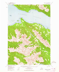
1951 Map of Juneau A-2
USGS Topo · Published 1962About this map
Stephens Passage separates the high ridges of Douglas Island from the northern reaches of Admiralty Island in this early 1950s survey. The landscape is defined by the sharp elevations of the Tongass National Forest, where landmarks like Eagle Peak and Mt Bradley rise above a network of drainages including the King Salmon River and Greens Creek. Evidence of early 20th-century industrial infrastructure is visible on the slopes of Douglas Island, specifically the Treadwell-Ditch, a significant water conveyance system built to support mining operations in the region.
Find a feature on this map
30 named features on this map. Tap any name to fly to it.
Don’t see what you’re looking for? This feature index may not catch every label — zoom into the map to look around manually.
Map Details
Editions of this 1951 Juneau A-2 Map
3 editions found

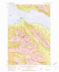
Other maps of this area

1947 · Juneau B-3
USGS Topo · 1:63,360

1947 · Juneau B-2
USGS Topo · 1:63,360

1948 · Juneau A-3
USGS Topo · 1:63,360

1948 · Sitka D-1
USGS Topo · 1:63,360

1948 · Sitka D-3
USGS Topo · 1:63,360

1948 · Sitka D-2
USGS Topo · 1:63,360

1948 · Juneau B-1
USGS Topo · 1:63,360

1949 · Juneau B-3
USGS Topo · 1:62,500

1949 · Juneau B-2
USGS Topo · 1:62,500

1950 · Juneau A-3
USGS Topo · 1:63,360