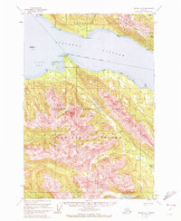
1951 Map of Juneau A-2
USGS Topo · Published 1972About this map
Admiralty Island and Douglas Island dominate this coastal survey, separated by the wide waters of Stephens Passage. This mid-century view captures the wilderness of the Tongass National Forest before extensive modern development, focusing on the high peaks and drainage systems that define the Alexander Archipelago. Along the northern slopes of Douglas Island, the Treadwell Ditch remains a prominent feature, tracing the contours above Gastineau Channel—a relic of the massive water infrastructure required for early gold mining operations in the region.
Find a feature on this map
33 named features on this map. Tap any name to fly to it.
Don’t see what you’re looking for? This feature index may not catch every label — zoom into the map to look around manually.
Map Details
Editions of this 1951 Juneau A-2 Map
3 editions found

Other maps of this area

1947 · Juneau B-3
USGS Topo · 1:63,360

1947 · Juneau B-2
USGS Topo · 1:63,360

1948 · Juneau A-3
USGS Topo · 1:63,360

1948 · Sitka D-1
USGS Topo · 1:63,360

1948 · Sitka D-3
USGS Topo · 1:63,360

1948 · Sitka D-2
USGS Topo · 1:63,360

1948 · Juneau B-1
USGS Topo · 1:63,360

1949 · Juneau B-3
USGS Topo · 1:62,500

1949 · Juneau B-2
USGS Topo · 1:62,500

1950 · Juneau A-3
USGS Topo · 1:63,360