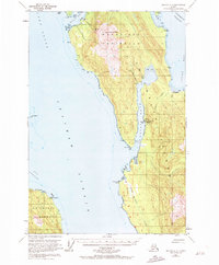
1950 Map of Juneau A-3
USGS Topo · Published 1972About this map
Industrial maritime activity and rugged coastal geography dominate this mid-century survey of the Mansfield Peninsula. Along the eastern shore of Hawk Inlet, the Hawk Inlet Cannery stands as a primary hub of activity, supported by a Seaplane Base, an Aqueduct, and a complex of Oil and Gasoline Tanks. This infrastructure illustrates the era's reliance on water and air transport for processing and logistics in the Tongass National Forest.
Find a feature on this map
35 named features on this map. Tap any name to fly to it.
Don’t see what you’re looking for? This feature index may not catch every label — zoom into the map to look around manually.
Map Details
Editions of this 1950 Juneau A-3 Map
3 editions found

Other maps of this area

1947 · Juneau B-3
USGS Topo · 1:63,360

1947 · Juneau B-2
USGS Topo · 1:63,360

1948 · Juneau B-4
USGS Topo · 1:63,360

1948 · Juneau A-3
USGS Topo · 1:63,360

1948 · Juneau A-4
USGS Topo · 1:63,360

1948 · Sitka D-3
USGS Topo · 1:63,360

1948 · Sitka D-2
USGS Topo · 1:63,360

1948 · Sitka D-4
USGS Topo · 1:63,360

1949 · Juneau B-3
USGS Topo · 1:62,500

1949 · Juneau B-2
USGS Topo · 1:62,500