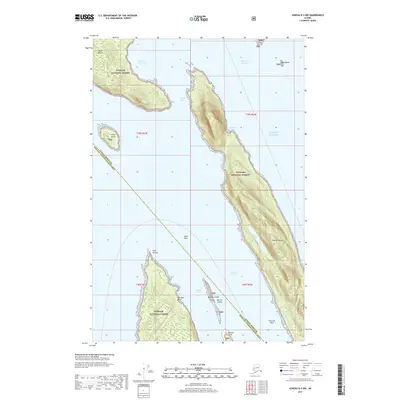
2017 Map of Juneau B-3 NW
USGS Topo · Published 2017About this map
Shelter Island and Lincoln Island dominate this coastal survey of the Inside Passage, where the deep waters of the Favorite Channel and Saginaw Channel meet. Located within the Tongass National Forest, the landscape is defined by its maritime navigation points, including the prominent Point Retreat and the hazardous Faust Rock. The island interiors show significant elevation changes, with Shelter Lake positioned on the high ground of the largest landmass. The coastal periphery is marked by small protected areas such as Lincoln Anchorage, Halibut Cove, and Shelter Cove, indicating the importance of natural harbors for vessels transiting the Gulf of Alaska. The boundary between the Juneau Borough and the Hoonah-Angoon Census Area bisects these waters, reflecting the administrative divisions of this coastal wilderness.
Find a feature on this map
22 named features on this map. Tap any name to fly to it.
Don’t see what you’re looking for? This feature index may not catch every label — zoom into the map to look around manually.
Map Details
Editions of this 2017 Juneau B-3 NW Map
This is the sole edition of this map. No revisions or reprints were ever made.
Other maps of this area

1947 · Juneau B-3
USGS Topo · 1:63,360

1948 · Juneau B-4
USGS Topo · 1:63,360

1948 · Juneau C-4
USGS Topo · 1:63,360

1949 · Juneau B-3
USGS Topo · 1:62,500

1949 · Juneau C-4
USGS Topo · 1:63,360

1949 · Juneau B-4
USGS Topo · 1:63,360

1951 · Juneau
USGS Topo · 1:250,000

1951 · Juneau C-3
USGS Topo · 1:63,360

1952 · Juneau C-3
USGS Topo · 1:63,360

1962 · Juneau B-3
USGS Topo · 1:63,360