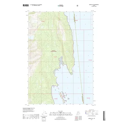
2017 Map of Juneau B-4 SE
USGS Topo · Published 2017About this map
Tongass National Forest dominates this coastal Alaskan landscape, where the dense wilderness of the Tnf meets the protected waters of Howard Bay. This 2017 survey by the U.S. Geological Survey details the shoreline along the southern reaches of the Lynn Canal, a major glacial fjord providing maritime access through the Alexander Archipelago. The terrain is defined by the sharp transition from the forested heights down to Point Howard, a prominent landmark that marks the entrance to the bay. The map also delineates the administrative boundary between the Hoonah-Angoon Census Area and the Haines Borough, which cuts through the open waters of the canal, reflecting the complex political geography of the Alaskan Panhandle.
Find a feature on this map
12 named features on this map. Tap any name to fly to it.
Don’t see what you’re looking for? This feature index may not catch every label — zoom into the map to look around manually.
Map Details
Editions of this 2017 Juneau B-4 SE Map
This is the sole edition of this map. No revisions or reprints were ever made.
Other maps of this area

1947 · Juneau B-3
USGS Topo · 1:63,360

1948 · Juneau B-4
USGS Topo · 1:63,360

1948 · Juneau A-3
USGS Topo · 1:63,360

1948 · Juneau A-4
USGS Topo · 1:63,360

1949 · Juneau B-3
USGS Topo · 1:62,500

1949 · Juneau B-4
USGS Topo · 1:63,360

1950 · Juneau A-3
USGS Topo · 1:63,360

1951 · Juneau
USGS Topo · 1:250,000

1962 · Juneau B-3
USGS Topo · 1:63,360

1962 · Juneau
USGS Topo · 1:250,000