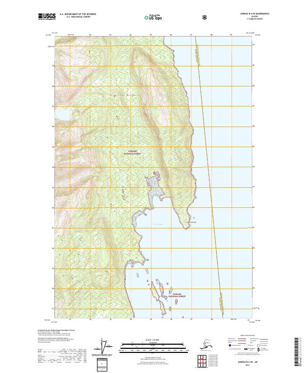
2021 Map of Juneau B-4 SE
USGS Topo · Published 2021About this map
Tongass National Forest dominates this coastal stretch of the Alaska Panhandle, where the southern reaches of the Saint Elias Mountains meet the waters of the Inside Passage. The landscape is defined by the deep indentation of Howard Bay, a significant natural anchorage protected by the prominent Point Howard to the north. This 2021 survey records the administrative boundary of the Haines Borough Hoonah-Angoon Census Area as it traverses the forested slopes and marine waters. The cartography illustrates a transition from the high, glacier-carved peaks of the interior to the complex, island-dotted shoreline, providing a clear view of the wilderness character of the region before any significant modern development altered these shores.
Find a feature on this map
11 named features on this map. Tap any name to fly to it.
Don’t see what you’re looking for? This feature index may not catch every label — zoom into the map to look around manually.
Map Details
Editions of this 2021 Juneau B-4 SE Map
This is the sole edition of this map. No revisions or reprints were ever made.
Other maps of this area

1947 · Juneau B-3
USGS Topo · 1:63,360

1948 · Juneau B-4
USGS Topo · 1:63,360

1948 · Juneau A-3
USGS Topo · 1:63,360

1948 · Juneau A-4
USGS Topo · 1:63,360

1949 · Juneau B-3
USGS Topo · 1:62,500

1949 · Juneau B-4
USGS Topo · 1:63,360

1950 · Juneau A-3
USGS Topo · 1:63,360

1951 · Juneau
USGS Topo · 1:250,000

1962 · Juneau B-3
USGS Topo · 1:63,360

1962 · Juneau
USGS Topo · 1:250,000