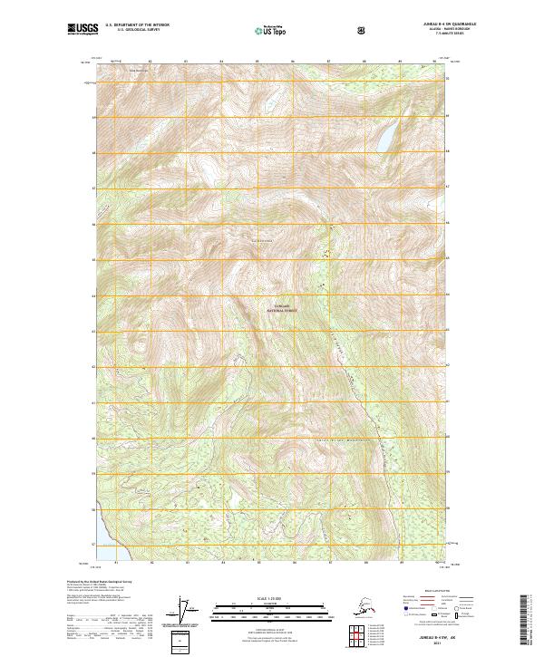
2021 Map of Juneau B-4 SW
USGS Topo · Published 2021About this map
Tongass National Forest dominates this coastal landscape in the Saint Elias Mountains, where the wilderness of the Haines Borough meets the northern reach of the Inside Passage. The terrain is defined by extreme elevation changes, rising from the tidal marshes of Icy Flats and the waters of Icy Strait to the named peaks of Shuk Da Doogú and Lulxooshá. While the region is largely roadless, a network of traditional routes and modern paths such as the West Swanson Trl, Bear Valley Trl, and Gux X'aagák'u provide the only terrestrial access through the dense forests and high valleys. Notable water bodies including Leech Lake and Lake View sit tucked within the interior, marking a landscape shaped by glacial activity and heavy precipitation characteristic of Southeast Alaska.
Find a feature on this map
21 named features on this map. Tap any name to fly to it.
Don’t see what you’re looking for? This feature index may not catch every label — zoom into the map to look around manually.
Map Details
Editions of this 2021 Juneau B-4 SW Map
This is the sole edition of this map. No revisions or reprints were ever made.
Other maps of this area

1948 · Juneau B-4
USGS Topo · 1:63,360

1948 · Juneau A-4
USGS Topo · 1:63,360

1948 · Juneau B-5
USGS Topo · 1:63,360

1949 · Juneau B-4
USGS Topo · 1:63,360

1950 · Juneau B-5
USGS Topo · 1:63,360

1951 · Juneau
USGS Topo · 1:250,000

1951 · Juneau A-5
USGS Topo · 1:63,360

1962 · Juneau
USGS Topo · 1:250,000
1994 · Juneau A-5
USGS Topo · 1:63,360
1995 · Juneau A-4
USGS Topo · 1:63,360